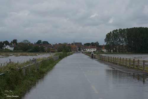
When the rains fall and the lowlands flood it is easier to see how the Isle of Purbeck got its name.
The western boundary, hidden somewhere amongst the hills around Lulworth, becomes the only dry walkway and would not have been an easy trek.
Some roads still flood when the rain is heavier than usual but there are always altenative routes. Most of which don't involve getting your feet wet.
The Isle of Purbeck is a peninsula on the southern tip of the the county of Dorset in England. The photographs I take, hopefully, help to express how I feel about this magical place and show you things which you may see if you come to visit. I am a full time, professional photographer and have a gallery in Swanage. Please feel free to click on the picture to see it larger or to look at my other photographs. www.purbeckfootprints.co.uk
Tuesday, 10 July 2012
More Of An Isle
Subscribe to:
Post Comments (Atom)
Quiet but never silent.
I missed the Sun this morning, not because I was late but because the early wander was done and dusted by the time the clouds cleared. When...

-
This morning we headed for the cliffs as the sky was clearer than it had been and it looked as if the day was going to stay that way. On...
-
I missed the Sun this morning, not because I was late but because the early wander was done and dusted by the time the clouds cleared. When...
-
Slip, Slide And Away , a photo by julian sawyer - Purbeck Footprints on Flickr. These are the kind of shots I would have liked of the wild ...


No comments:
Post a Comment